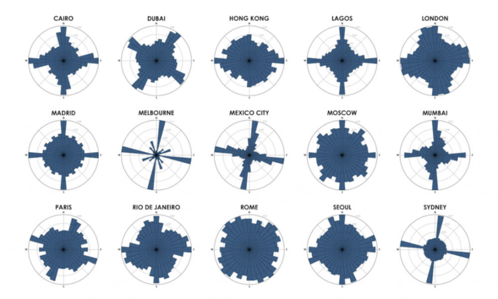
Geoff Boeing, Urban planning professor at Northeastern University, has developed a tool to visualize the consistency of a city’s street network. Boeing’s tool calculates what percentage of a city’s roads run along each section of a compass, and plots it on a circular bar chart. A similar concept was created recently by data scientist Seth Kadish.
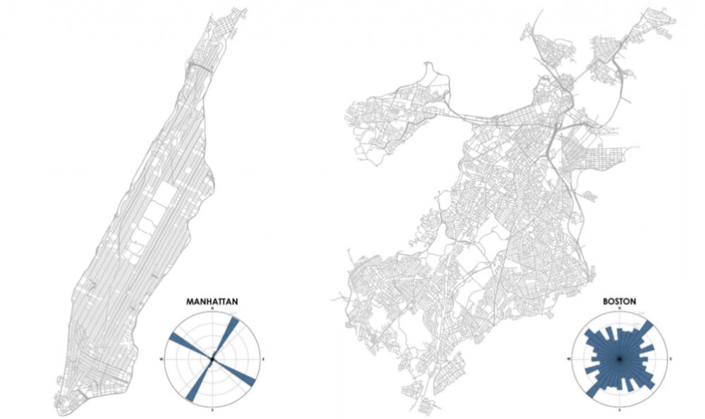
Let us look at how the tool works on two examples – the Manhattan island and Boston. Streets on Manhattan run from south-southwest to north-northeast. Most streets are parallel or perpendicular to each other and form a regular grid. That is why the graph representation of the streets looks like four long bars. The shorter bars on the graph represent those few streets that don’t line up with the grid. The street network graph of Boston is quite different. The streets in Boston run in every direction, so the graph looks more like a circle.
Boeing explained his motives for creating the tool: “These street networks organize all the human activity and circulation in the city. I think these visuals can help make otherwise dry or technical city planning concepts more salient and approachable for laypersons. You can easily see and comprehend your own city and how it relates to others’ patterns.”
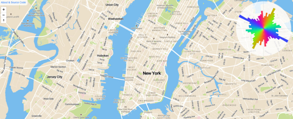
Developer Vladimir Agafonkin built on Boeing’s work to build a version for web browsers. This version can be used by everyone – no need for any programming skills.
Hopefully, this program will make the citizens more interested in the urban design of their surrounding. Boeing said that “One of my main goals is to empower other people without a Ph.D. in city planning or a strong background in computer science to explore their own cities and discover their own patterns and relationships.”
Photo source: https://www.citylab.com/transportation/2018/07/see-your-citys-street-structure-with-these-tools/566138/ ;Credit: Geoff Boeing